


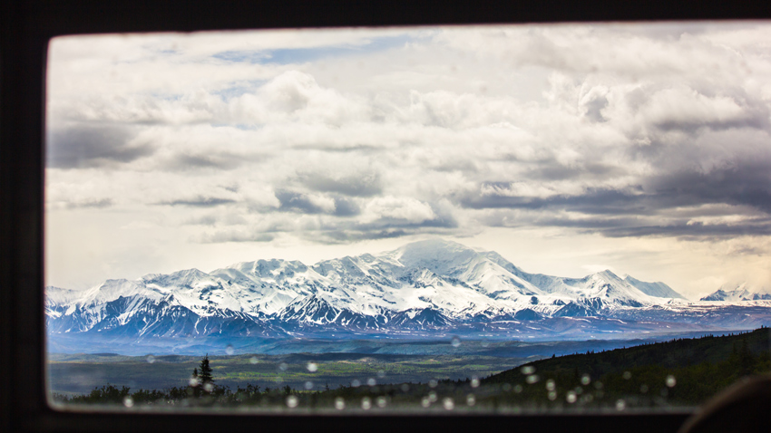
A vast area of wilderness leads to Alaska Range slopes and glaciers surrounding Denali, cloaked behind dense clouds, from through a starboard window aboard the Kantishna Experience tour bus.
MP 86.5 Denali Park Road, Denali National Park and Preserve, Alaska: Friday, 16 June 2017
part of the Denali National Park and Preserve album
Typical during the summer months, Denali (formerly Mount McKinley) was shrouded in dense clouds and fog layers during most of my viewing opportunities in Denali National Park and Preserve. Fortunately, there were a few exceptional moments when I did see this spectacular 20,310-foot mountain. Doing so allows one to claim membership in the so-called Thirty Percent Club, a reference to the low probability of glimpsing this elusive landmark, and I was fortunate to join multiple times.
With this uncertainty, one must make the most of any opportunities because there may not be another. I figured that my first and possibly best chances would occur during the Kantishna Experience bus tour, a twelve-hour excursion to the end of Denali Park Road and back — one hundred eighty-one miles in Blue Bird 120570, a "Type D" former school bus painted akaroa instead of neon yellow, plus another mile on foot at the far western end. Unfortunately, the weather on this day was not particularly cooperative and primarily featured thick clouds, limited visibility and, as we were out walking that last mile, pouring rain.
It was on the return voyage, about six miles east of the road's terminus in Kantishna, when another visitor excitedly informed the group of a developing viewing window. At first, only the surrounding Alaska Range topology emerged from the clouds and allowed me to capture the header photograph. After continuing another 4.6 miles east and stopping at a clearing, the massive nature of Denali finally presented itself. All of the clouds make it very difficult to determine and appreciate its size.
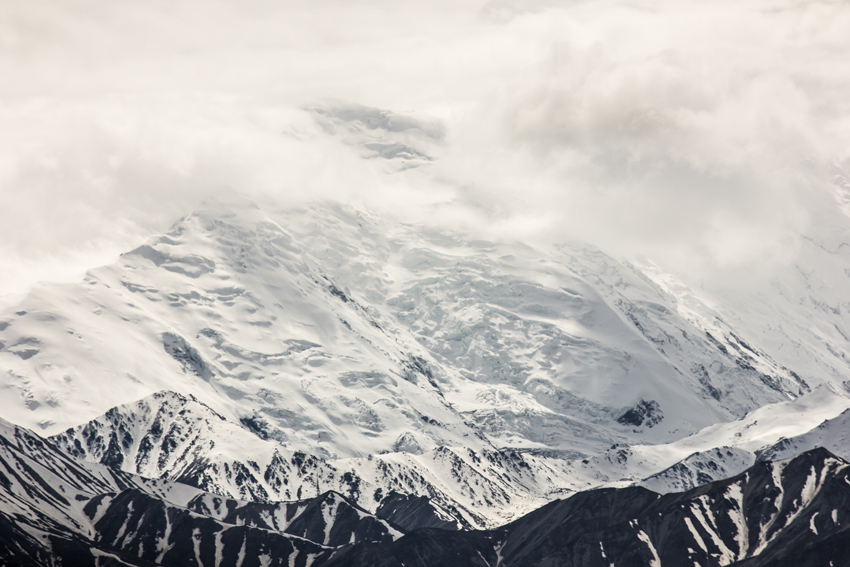
To illustrate, here is an image captured with the lens set to 235 millimeters. In the moment, I mistakenly thought that this large jagged versant was "the tall one" itself but is actually Mount Tatum (elevation 11,053 feet) just northeast of Denali.
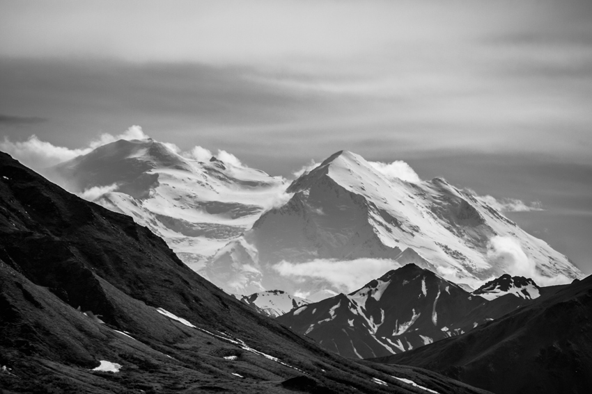
With the lens at fifty-five millimeters instead, you can see how Mount Tatum blends into a craggy panorama yet is overshadowed by Denali, which tops out at nearly twice the height. The yellow rectangle represents the frame of the previous photo, while the green line shows Denali's maximum height.
Can you locate the summit? It takes a moment to spot even knowing where to look. Click-through twice to the full-size photograph to see in more detail.
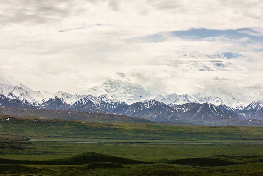
One hundred and sixty minutes (nearly twenty-nine miles) later, as we were driving away from the Toklat River Contact Station, the clouds finally abated and give our group the clearest view yet. From a relatively low elevation and with obscuring terrain in between, Denali does not look nearly as massive from this location's perspective.
Following the tour, I was disappointed that I was unable to truly photograph Denali from Park Road's more famous vistas such as Stony Hill Overlook, Eielson Visitor Center and the Reflection Pond, even though we stopped at each one and I shot hundreds of frames. The tour was otherwise excellent and featured moose, brown bear, caribou and great horned owl.
What I did not know at the time was that crystal clear weather would be present twelve days later as I flew to Utqiaġvik.