 Information Links, Photographs and News
»
WESH Channel 2
»
WKMG Channel 6
»
WFTV Channel 9
»
Central Florida News 13
»
WMFE Channel 24
»
Weather Watches and Warnings
»
National Hurricane Centre
»
Local Radar
»
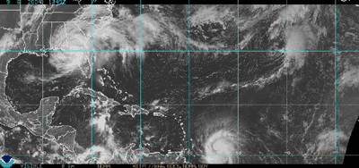
Visible Satellite Loop
»
Visible Satellite (still frame)
»
State of Florida Resource Links
»
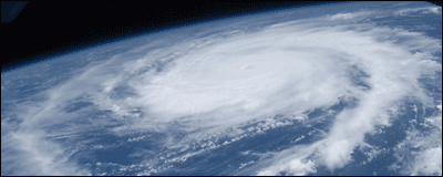
NASA: Frances from the ISS
»
Rough Seas and Surf at Fernandia Beach, Florida
» 17.9 MB QuickTime video; Filmed by Marty Hoskins
Monday, 06 September 2004, 1453
Power has been restored! With any luck it will stay on this time. Our camper has a leak, we lost a few screen panels and a side fence/gate, but that is all. Very fortunate, indeed.
I will now be resuming somewhat normal operations here and and discontinuing further updates to this thread. Thank you for visiting and please come again.
Monday, 06 September 2004, 1300
Although power was restored while I was out enjoying breakfast at a very, very busy Perkins restaurant, it went out again before getting home. Damage in the northern part of town where I live is minimal to moderate, with some structures taking some heavy damage but for the most part not. Charley basically wiped out most unstable structures and trees so Frances had little left to destroy. I have heard, however, that in parts of southern Orlando the damage is much more severe. I will write again in more detail once I again have power.
Sunday, 05 September 2004, 1650
The worst seems to be over here. It is still wet and rainy, though. We continue to be without power and have sustained minimal damage only. My battery is near death so I do not expect being able to post again until electrical power is restored. At that time, I will provide more details about the experience.
Sunday, 05 September 2004, 0925
I was awakened by the substantial increase of winds and rain. It seems some of the actual storm has finally arrived. We lost electrical power at about the same time so I am doing to turn my computer off and only post again with breaking news. Good luck to everyone in the area.
Saturday, 04 September 2004, 2357
It is only minutes away from the official start of, believe it or not, day four of
Mount Sutro's live coverage of Hurricane Frances and the storm has left this part of town relatively unscathed. For now, at least. The gusts of wind and rain have been becoming more and more frequent and should continue to increase in strength and frequency over the course of the next hour or so. Officially making landfall at around 2300, it is hard to believe that a storm so large and so close has done very little here as so far. Reports from the coastal communities indicate massive flooding, moderate damage and wind gusts in excess of 115 miles per hour. My area is under just about every official watch or warning in the book as we wait for the bulk of the storm to arrive. I am going to watch a movie now while I still have electrical power and maybe even nap a bit before the nasty bits arrive. I will post throughout the night with any news of note.
Saturday, 04 September 2004, 2147
At this rate, Frances might be here all week! So far we have experienced much more of the same intermittent bouts of heavy rain and wind separated by calm and cool conditions. The coastal areas are having more trouble so far, since the stronger storms are moving so slowly. But they are heading this way, so we shall soon (depending on your perception of time, I suppose) have our share of rain, floods and damage.
Saturday, 04 September 2004, 1836
Fortunately the storm front that prompted the Tornado Warning failed to produce any significantly severe weather and for the most part did very little at all here. The electricity has flickered a few more times but has not fully gone out at any point. The local news crews that are stationed at various coastal locations are broadcasting some fairly impressive video of unruly seas and some preliminary damage. I forgot to mention earlier, but a few hours ago the temperature dropped significantly. If it were not for the rain and dangerous wind, it would be a great night to spend outside.
Saturday, 04 September 2004, 1732
Seminole (where I live) and Volusia County north of here are now under a
Tornado Warning until 1800. A powerful cell is moving this way at sixty (60) miles per hour!
Saturday, 04 September 2004, 1549
Electrical power has started to fluctuate and the rain has come back with a vengeance. The gusts of wind blowing through right now are moderate, but enough to do some damage. According to the
radar loop, after another brief pause, tropical storm force (and stronger) cells will move in and occupy the area for hours thanks to the storm moving so slowly.
Saturday, 04 September 2004, 1457
A second rain band just blew through and I had the pleasure of driving in it. I discovered I had left my mobile telephone in a friend's car and drove to his place to retrieve it. Major roadways are deserted, many if not most businesses and homes have boarded up, an eerie quiet fills the air and the wind and rain are powerful, even at this elementary level.
Saturday, 04 September 2004, 1149
We are experiencing the outer bands of the storm this morning. It is raining and windy as hell. In fact, I was just awakened from a nap by the sound of tree limbs slamming into the plywood covering my bedroom window. That first rain band has been reported to spawn several tornadoes and also created winds that damaged power lines south of Orlando, in Osceola County.
It will be like this on and off for the next several hours while we wait for the real storm to arrive. The course has changed slightly, now more to the northwest and on a more direct route to this area. It still looks to pass south of here, however. The eye has redeveloped and strengthening has occurred in the past twelve hours, now packing maximum sustained winds of 105 MPH, making Frances a mid-range
Saffir-Simpson Category Two.
Now that Frances is here (finally), I will update as necessary for as long as I have the means to do so. As I mentioned before, my notebook's battery situation is even worse than before so it is unlikely I will get more than one or two short entries posted after electrical power is disabled. To my neighbours and friends, good luck! Check out all new
Metroblogging Orlando, a site where I author, where other local folks are posting their perspective through the storm.
I will leave you for now with my governmental televised "hero speech" quote-of-the-morning, uttered by someone in the Osceola County government: "Bad is on the way." Earlier someone ended their talk with a few lines damn near lifted from the President's national address in the apocalyptic summer flick,
Deep Impact.
Friday, 03 September 2004, 2224
You know that old woman in the left lane of the interstate driving her tan 1984 Cadillac coupe forty miles an hour under the speed limit with her turn signal on perpetually?
Her name is Frances.
Friday, 03 September 2004, 1441
Storm got you down? Dying to try the overrated
Gmail? I have six (6) more invitations for anyone who is interested. Send your requests to: gmail @ mountsutro.org
Friday, 03 September 2004, 1335
The storm's forward motion has slowed so they are now saying we will not experience the fun stuff until tomorrow. Oh, and they are now saying the eye track will come directly across metro Orlando. I am over this already and it has not even begun yet.
Friday, 03 September 2004, 1140
I went downtown last night to retrieve my mail and hit an ATM before the weather becomes inclement. Learning from Charley, most of the billboards that line Interstate-4 have had their faces removed, leaving only the superstructure. The idea behind this is that the wind will flow through the giant signs instead of pounding against them and causing them to fail structurally. It is an eerie sight.
Word on the street is that fuel trucks will no longer service the area so if you do not already have fuel in your vehicle, you are pretty much screwed. It looks like we will start experiencing some of the outer bands of the storm within a few hours. The track still looks to be a bit south of here, which for me personally is a good thing. Of course, these storms are inherently unpredictable so we will just have to wait and watch.
Thursday, 02 September 2004, 1700Dear Neighbors:
In a briefing with Mayor Dyer, OUC representatives advised us that they are very concern about the possibility of losing entire power stations located in Eastern Orange County. All of their power stations are located there. If they lose the Stanton Power Plant, they will need to bring power from our Florida West Coast. Because all of their power stations are located in the path of Hurricane Frances, for the first 48 hours they will fly helicopters over their power lines from their plants inland. They will not begin addressing our needs until that task is accomplished. Remember that they first restore hospitals, police stations and fire stations. Secondly, then they restore power to communication companies, such as television stations and radio stations. Thirdly, they restore power to our street. Fourthly, they restore power to our commercial districts. Fifthly, they restore power to our schools. Lastly, they restore power to our residential neighborhoods.
OUC has advised us that it is highly unlikely that they will restore any power to our neighborhoods for a minimum of 3 to 5 days. Unlike Hurricane Charley wherein they could restore electricity on a neighborhood by neighborhood basis, they anticipate the damage could be so significant the restoration process will result in a greater number of homes coming on at the same time–slower process–however more brought on line at one time. Please also remember that we are unable to send out certain crews to clear streets of debris until OUC approves that the lines are dead. Therefore, please be prepared that you may not see any activity on our part for 72 hours.
OUC is bringing in crews from the Western and Midwestern states, including Texas and Colorado. They are strategically placing the crews throughout our city. In fact, at 9:00 p.m. last night I saw a large Texas Disaster Relief Center trailer vehicle in the Trotters Park area.
As to flooding, Hurricane Charley was a very fast storm with little rain. On the other hand, Hurricane Francis is expected to dump a lot of rain on our area. You can obtain sand bags at our Public Works Department at 1010 S. Woods, which is located near Gore and Citrus Streets. You can reach them at (407) 246-2238. Each person is allowed 10 bags. Please prepare for flooding.
Sincerely,
Vicki Vargo, Mayor Pro Tem
City of Orlando Commissioner District 3
Thursday, 02 September 2004, 1450
The latest forecast models are predicting the outer bands of Frances will begin to affect local weather by Friday evening, around 2000 hours. Mandatory evacuation orders for coastal counties are in effect and toll roads are now offering free service to assist in the mass exodus.
It is also being said that the eye of Frances will move across the area south of Orlando in the Kissimmee, Florida area, a location hit hard by Charlie only three weeks ago. Lines for gas and supplies have been forming all morning. The station where I fueled was offering only regular unleaded gasoline to help more people get fuel quickly. People are also outside fanatically trying to clean-up the debris that remains whilst boarding up and getting supplies ready.
Thursday, 02 September 2004, 1102
Here we go again. Local recovery efforts are still underway after our visit from Charley and now Frances looks to drive through only weeks later. I am heading a little north to the hospital where I had my cholecystectomy to pick-up my gall stones, saved per my request. I will make updates to this post as needed to provide the same coverage as I had for Charley. A warning, however, that my notebook battery is in even worse shape than before so if and when electrical power is lost, I will likely only be able to post once or twice.
We are currently under a Flood Watch, Hurricane Warning and Hurricane Wind Warning.
